Hurricane Debby's Impact: Increased Damage Reported Outside of FEMA Flood Zones
Hurricane Debby has resulted in significant damage, particularly in areas that are typically not known for flooding. What was once considered a safe zone has experienced unexpected destruction, highlighting the unpredictable nature of severe weather events. The impact of the storm has prompted residents and officials to reassess their preparedness for future hurricanes, as the devastating effects extend beyond FEMA noted flood zones.

Hurricane Debby's Unanticipated Devastation


Hurricane Debby, a storm that wreaked havoc across the southeastern United States, particularly Florida, has highlighted significant gaps in our current flood risk assessments.
The storm, which began as a tropical depression on July 31, 2024, and intensified into a Category 1 hurricane by August 3, caused unprecedented damage, much of which occurred outside of FEMA-designated Significant Flood Hazard Areas (SFHAs) according to a recent report by First Street Technology Inc.
This unexpected pattern of flooding calls into question the adequacy of existing flood maps and the methodologies used to predict flood risks.
Overview of Hurricane Debby’s Path and Impact
Hurricane Debby made landfall on August 5, 2024, near Steinhatchee in Florida's Big Bend region. The storm's slow movement, combined with heavy rainfall, led to severe flooding in multiple states. Florida, particularly its Big Bend region, experienced some of the worst impacts, including a nearly 6-foot storm surge in Cedar Key. As the storm moved inland, it brought catastrophic flooding to Georgia, South Carolina, and other parts of the Southeast.

A map of total rainfall accumulation over 72 hours (August 4th-6th), showing the cities who experienced flooding as a result of Hurricane Debby Source: First Street™
The slow progression of the storm amplified the impact, allowing for prolonged exposure to heavy rains and high winds. This led to widespread power outages and significant damage to infrastructure, particularly in areas like Sarasota, the Florida-Georgia border, and coastal South Carolina.
First Street’s Flood Model: Reality of Debby’s Impact

To better understand the flooding caused by Hurricane Debby, First Street used a sophisticated flood model that simulated the event using observed rainfall rates and pluvial components.
The model accurately predicted flooded areas, aligning closely with reports from media sources and homeowners.
Despite these predictions, the scale of damage outside FEMA’s SFHAs was shocking.

The findings from the First Street model revealed that an alarming 78% of the properties affected by Hurricane Debby were located outside of FEMA's designated flood zones.
This unfortunate circumstance resulted in an estimated total of $12.3 billion in damages, with a substantial $9.7 billion of that total occurring outside FEMA’s Special Flood Hazard Areas (SFHAs).
This data highlights a critical issue that impacts a significant number of homeowners across the country: The current FEMA flood zone maps may not accurately represent the true risk of flooding in various regions…
As a result, this discrepancy leaves many homeowners dangerously vulnerable to potentially devastating uninsured losses during severe weather events, which could have been mitigated with better-informed flood risk assessments.
The Geographic and Financial Toll of Hurricane Debby
Hurricane Debby’s impact was not evenly distributed, with Florida bearing the brunt of the storm’s fury. In the state, counties like Hillsborough, Duval, Pasco, Marion and Manatee saw some of the highest damages, with rainfall rates exceeding the 200-year return period. Sarasota, in particular, faced record-breaking rainfall, resulting in widespread inland flooding and significant property damage.
Other notable regions that have experienced heavier than normal rainfall were Fairfax Virginia, New Hanover and Wake North Carolina as well as Charleston South Carolina.


Rainfall frequency and damages for a 24-hour maximum rainfall period from Hurricane Debby - FirstStreet.Org
In total, the storm affected approximately 385,000 properties, with around 160,000 experiencing some level of damage. Of these, about 124,000 properties, or 78%, were outside FEMA's SFHAs. The financial implications are staggering, with estimated damages ranging from $9.5 to $15.8 billion. Of this, uninsured damages are estimated to be between $7.6 and $12.6 billion, highlighting the critical need for more accurate flood risk assessments and better insurance coverage strategies.
Reevaluating Flood Risk Assessments Post Debby
The data collected from Hurricane Debby makes a compelling and urgent case for reevaluating how flood risks are assessed throughout the United States. The current reliance on FEMA’s flood maps for identifying flood-prone zones, which unfortunately did not predict the vast majority of the extensive damage caused by Debby, is clearly insufficient and warrants serious consideration for improvement.

As climate change continues to alter weather patterns, storms like Debby may become more common, and our current methods of predicting and mitigating flood risks may become increasingly outdated.
First Street’s flood model, which uses a combination of simulations, offers a more accurate representation of flood risks. By integrating high-resolution topographic data, historical rainfall records, and the latest climate models, First Street's approach could provide a better foundation for future flood risk assessments.
Moving Forward: Preparing for Future Flood Risks

In light of the lessons learned from Hurricane Debby, there is a pressing need for local, state, and federal agencies to update their flood risk assessments. This includes incorporating models like First Street’s, which take into account the changing nature of storm patterns and the increasing likelihood of extreme weather events.
Additionally, there is a need for better public awareness and education about flood risks, particularly in areas that are not currently designated as high-risk by FEMA. Homeowners should be encouraged to invest in flood insurance, even if they are not in a designated flood zone, to protect against the financial devastation that can result from events like Hurricane Debby.
Finally, the biggest impact for those in these areas moving forward is the need to always have dedicated flood protection solutions on hand despite the FEMA designation. Often, some will believe since they do not reside in a designated flood zone that they will remain clear of impactful flooding from severe storms. Hurricane Debby has proved that areas outside of FEMA’s designation face just as much risk.
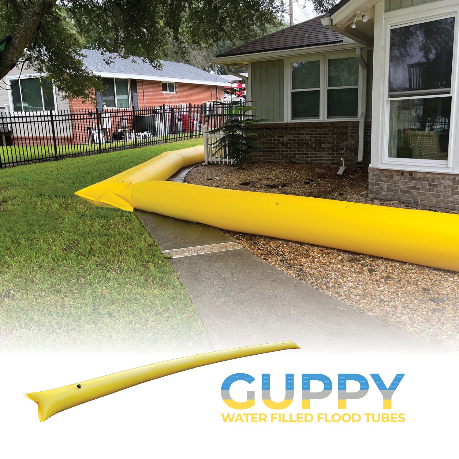
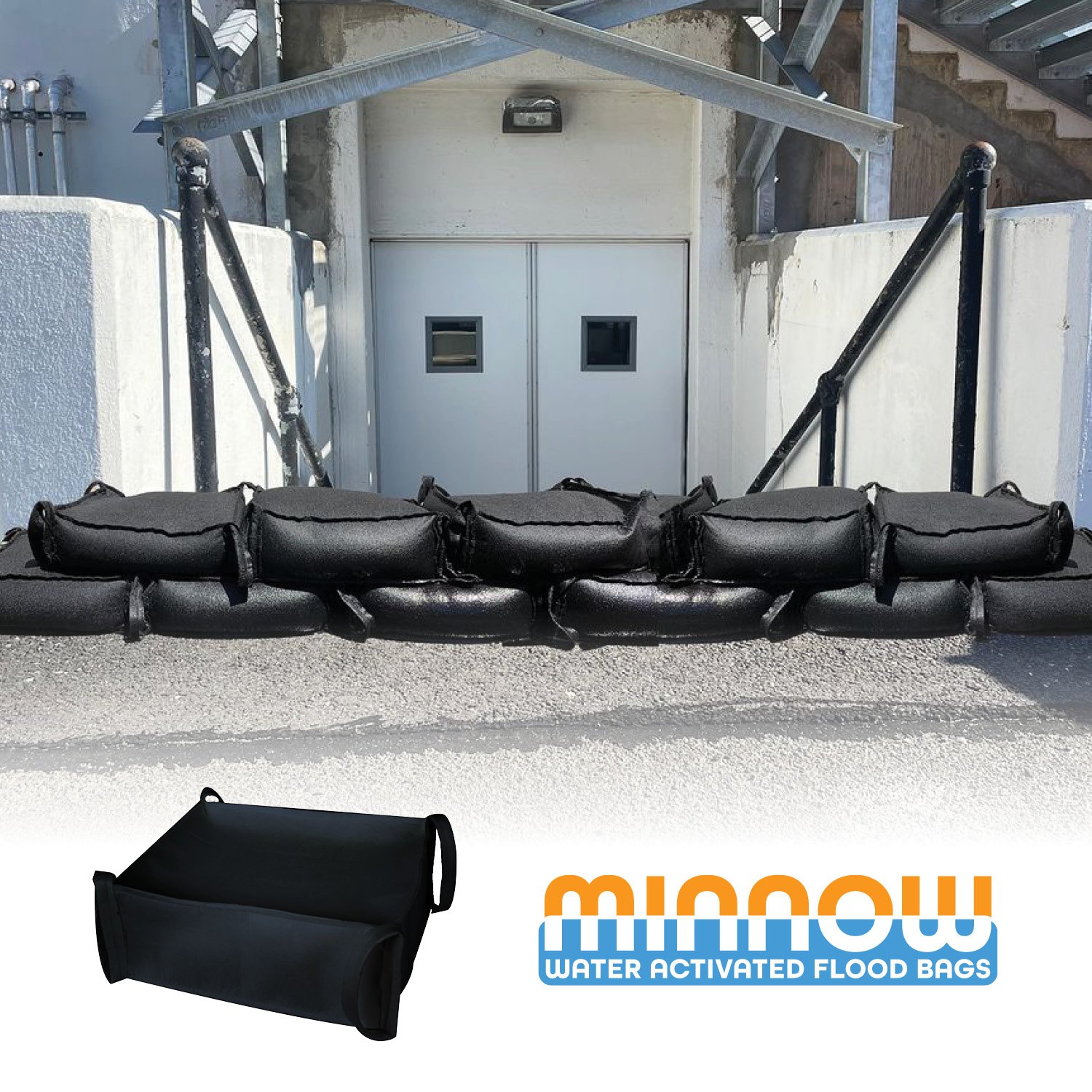
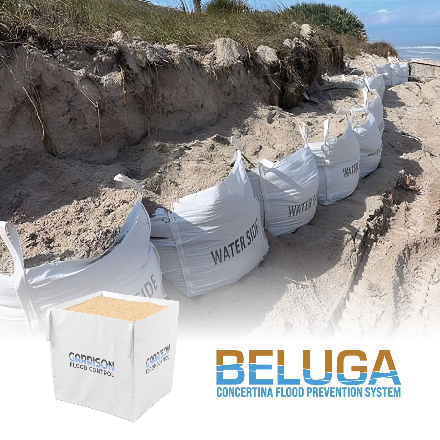
Therefore, being proactive and finding more innovative flood solutions to have on hand and ready to deploy is extremely important. While bulky traditional sandbags still have their purpose, it is no longer an efficient method of proactive flood protection. Today, more modern solutions are available that allow you to not only store your protection compactly, but quickly deploy it as well.
Staying Prepared With Garrison Flood Control
Hurricane Debby has exposed significant flaws in our current flood risk assessment and preparedness strategies. The staggering number of properties affected outside of FEMA-designated flood zones, and the billions of dollars in uninsured damages, highlight the urgent need for changes in preparedness.
Having the appropriate solutions to always be prepared for a flood threat is more important now than ever before, whether you are in a designated flood zone or not. As shown by this recent hurricane, flooding can happen anywhere quickly.
Garrison Flood Control provides a wide variety of flood protection systems and solutions that help fit the needs of your property. With a range of products, including Flood Barriers, Flood Walls, Water Dams and Water Diversion Systems, Garrison Flood Control combines innovative engineering with durable materials to provide effective and reliable flood protection. Their solutions are tailored to meet the unique needs of each client, ensuring comprehensive protection against rising waters and helping to minimize damage during flood events.


View The Hurricane Debby Impact Video

Garrison™ Flood Control is a New York-based manufacturer and distributor of a complete line of flood control products. Garrison products contain, divert, and re-route water away from valuable property, equipment, infrastructure, and facilities and help prevent flood damage due to rising water levels.
For additional information about Garrison™️ Flood Control Systems, please call 929-299-2099 or email sales@garrisonflood.com.
